History
2014 Victoria Strait Expedition
This year's search is about much more than underwater archaeology. The Victoria Strait Expedition will contribute to northern science and communities.
- 1205 words
- 5 minutes
This article is over 5 years old and may contain outdated information.
History

September 1, 2014, 23:00 Mountain Standard Time
Light winds, open water and relatively calm seas made for a perfect day to get all of the equipment in the water and in the air, and advance multiple project goals simultaneously. The northern search area remains difficult for boat work. Patience is the key up here, so we will go hard wherever the ice and weather let us work. Our current area down in the south is a location we have been searching since 2008, and it remains an area of interest. So, we will continue to cover more of this spot.

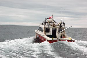
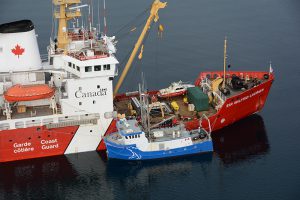
Immediately after breakfast, Parks Canada’s Investigator, along with its autonomous underwater vehicle, was launched back in the approach to O’Reilly Island, followed by the Canadian Hydrographic Service’s Gannet and Kinglett which were deployed toward their survey blocks. Lead hydrographer Scott Youngblut’s team had also engaged the multibeam on the Laurier very early in the morning so the onboard hydrographers Arthur Wickens and Ryan Battista kept themselves very busy processing the near real-time data throughout the day.
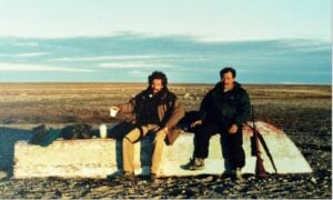
Our terrestrial archeologists were also eager to work today, and were able to grab the extra seats in the helicopter with Youngblut as he headed to one of the unnamed islands in the southern area. Besides the ongoing multibeam work, the hydrographers routinely establish global positioning stations onshore. These are critical to ensuring the positional accuracy of their surveys. While Youngblut set up the GPS station, archeologists Douglas Stenton and Robert Park conducted archeological surveys, located several Inuit tent rings and mapped sites using the ground-based LiDAR. The pilot stayed with them, keeping an eye out for hungry predators. Luckily, they only attracted curious caribou. The ability to share resources and assets between the various agencies aboard is a fundamental element of this project.
Are you passionate about Canadian geography?
You can support Canadian Geographic in 3 ways:
History
This year's search is about much more than underwater archaeology. The Victoria Strait Expedition will contribute to northern science and communities.
History
Introductory insights into the Canadian Coast Guard’s role in the search area

Environment
RCGS Fellow Jacqueline Windh jumped at the opportunity to participate in a six-week cleanup along the coast of B.C.
History
Arctic historian Ken McGoogan takes an in-depth, contemporary perspective on the legacy of Sir John Franklin, offering a new explanation of the famous Northern mystery