History
2014 Victoria Strait Expedition
This year's search is about much more than underwater archaeology. The Victoria Strait Expedition will contribute to northern science and communities.
- 1205 words
- 5 minutes
This article is over 5 years old and may contain outdated information.
History

August 26, 2014, 15:00 Mountain Time
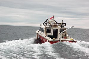
The 25-knot winds calmed slightly in the afternoon and we carried on with our navigational aids servicing operations. A wind like this does not impact our helicopter operations, but it does force us to take a close look at sea state for the hydrographic launches to conduct fieldwork safely. Throughout the day my crew kept busy building and installing beacons, as well as maintaining navigational aids on at least four small islands in the area.
As predicted by Environment Canada’s weather forecast, the winds in the afternoon eased, and by mid-day the Gannet and Kinglett were away to continue their surveying in Requisite Channel. The hydrographers have collected a significant amount of data over the past several weeks, and the analysis of that data through specialized geographic information system software is also conducted onboard. Archeologists Douglas Stenton and Robert Park will also be reviewing and scrutinizing their recent survey data collection. Up here, everybody makes hay while the sun shines (and processes the data when it doesn’t).
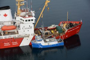
Later tonight, we’ll be making our start toward Cambridge Bay for refueling and resupplies. We’re also picking up the rest of our team, including colleagues from Parks Canada who will begin their search elements from the Laurier. It will be nice to see our old friends back aboard. We have built a strong working relationship with Parks Canada over the years and it feels great to shift from the planning cycle of the Victoria Strait Expedition into its operation. Once they’re safely aboard, we’ll begin preparations for our official leg of the search. And while the Franklin elements are certainly drawing well-deserved attention, every partner under the Victoria Strait Expedition umbrella will be continuing to make advances in other areas, including sea bed surveying, land-based archeological surveys and navigational enhancement work. This being the Arctic, the weather and ice is predictably requiring us to make adjustments to the marine search plans, and this is shaping up to be a very busy and exciting few weeks!
Are you passionate about Canadian geography?
You can support Canadian Geographic in 3 ways:
History
This year's search is about much more than underwater archaeology. The Victoria Strait Expedition will contribute to northern science and communities.
History
Introductory insights into the Canadian Coast Guard’s role in the search area
History
First official day of the 2014 search for Sir John Franklin’s lost ships
Exploration
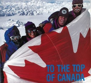
In 1992, a team backed by The Royal Canadian Geographical Society became the first to accurately measure the height of Mount Logan, Canada’s highest peak