Travel
Trans Canada Trail celebrates 30 years of connecting Canadians
The trail started with a vision to link Canada coast to coast to coast. Now fully connected, it’s charting an ambitious course for the future.
- 1730 words
- 7 minutes
This article is over 5 years old and may contain outdated information.
Mapping
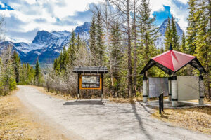
Nearly 200 events are being held across Canada today to celebrate the near completion of the Great Trail. Stretching over 22,000 kilometres from coast to coast to coast, the Great Trail (formerly known as the Trans Canada Trail) is more than 90 per cent completed. A dream nearly 25 years in the making, the Great Trail is the world’s longest network of recreational trails.
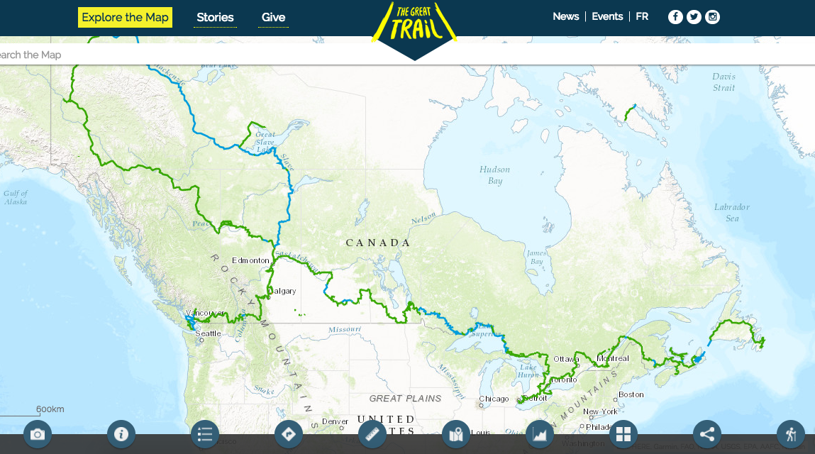
But to fully enjoy a great trail, you need a great map. This stunning interactive map of the trail was created by Esri Canada and shows not only the trail’s path over land and water, but also shares photos and community tips from all the people to share and enjoy this unique national resource.
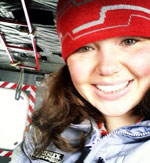
Here, Alex Miller, the president of Esri Canada, discusses the map and the ways in which technology and outdoor exploration can complement each other.
Why was getting involved with the great trail project important to you and Esri?
We’ve been involved with the trail since the 90s. In fact, when the TransCanada trail was first created, we donated the software to the trail organization to help them map out where the trail is going to be. So when they approached us about a software donation we suggested that we would be interested not just in that, but in helping them make better use of it. And in particular we wanted to pair it with our project—a new project at the time—this was back in 2009 when we came up with this idea working with governments and municipalities across the country to create a web map that would include topography and things of interest to people who like the outdoors, but also to professional map users as well. Our vision and timeline for this community map aligned with the Trail’s so we pledged a major donation of software, services, support and money for the trail.
What kind of reaction have you had from people that are already using the map?
I think it’s been very good, they’re all quite surprised at the level of detail and the interactivity. The map really serves two purposes. One, it is for the public and the other is for the people who maintain trail. I think that’s partly what makes our technology different from consumer mapping is that you have both covered. So both the people managing and running the trail and the people using the trail are both singing off the same map book if you will. That’s a huge benefit and hopefully those people that are maintain the trail will be contributing to richness of the map and the richness of the story of the trail that can be consumed directly by trail users.
How do technology and mapping play into and support outdoor exploration in modern society?
Technology is a major driving force in society and mapping is no different, in fact, mapping in many ways was one of the very early applications of computers and technology. If you look at the trail, it’s connecting people. We wanted to provide as much help as we could to not just plan the trail on the back end but also provide an application on the front end so that people could explore the trail virtually. And then when they’re on the trail, they can use the app on their mobile device and share their own experience. Mapping and GIS on the trail will become a tool that connects the local community to the trail. It’s our vision that people who live near the trail or around the trail start thinking about how as a community they can maintain the trail and be advocates for the trail and GIS and story maps are a way to tell stories that will encourage people to do that.
What’s the balance between using technology as a way to get more people outside and ensuring they’re still engaging with nature?
People who say that being outside and technology are in conflict with each other have never been lost in the woods before. Digital maps and GPS make life far safer – they save lives. If you’re just walking on the trail seeing two walls of trees, but then gee, you look at your map and there’s a waterfall maybe 300 metres off the trail so you cut into the bush to go see it. GPS provides a safety net. You also get a chance to share your experience on the trail in real time.
Are there any other features of the map that you’re particularly excited about?
The thing that I’m most excited about is it’s a community map. We’ve got thousands of communities across the country that contribute to it and I’m hoping to help organize the communities to be sure they provide the kind of updates around the trails that the trail users will find useful. One of the big uses of our map that we’re moving into is supporting emergency service responses. One of the problems with dialing 911 is they expect you to be dialling from a landline with an address. And if you dial it from a cell phone they don’t know where you are. We’re working with the province of New Brunswick to build that out and really, dramatically improve this.
This is certainly something that’s going to benefit the trail as well. If we’re going to get more Canadian to use the trail, some of them are going to end up with twisted ankles or fall off their bike, or heaven forbid have a heart attack out on the trail, they need to be rescued fast, so we’ll make the trail part of the whole network that’s supported by emergency services.
What’s the trail’s future going to look like, technology-wise, 10 years down the road?
One of the big new things that’s happening in mapping is using drones to make detailed maps. A year ago we produced a new product that takes images from a drone and puts them together using a GPS on the drone into an incredibly detailed map. I see people out on the trail with drones. It’s a different way of recording themselves. And drone makers are all saying that in ten years these drones will have 5-6 hours of flying time, so you can envision the Trans Canada trail people sending a drone out every week to check trail conditions and maintenance needs.
If you look 10 years out computing is going to be far more pervasive. You’ll be wearing glasses with augmented reality put in, so when you’re walking along the trail as you turn your head you can turn on interesting flora and fauna or turn on interesting historical events that might have happened on here.
What does the trail mean to you?
The TransCanada trail is for me a metaphor for trails everywhere. Every community should have their branch of the trail. The trail that’s been built is a backbone. It’s sort of the main artery, but now we have to build all the little capillaries and have it networked together so we end up with a much healthier population because they’re out in the outdoors understanding geography.
A lot of people today talk about the triple bottom line: strong economy, sustainable environment and strong society. For me, the trail touches all of those. It gets people out hiking and having a healthy lifestyle and as Robert Bateman says ‘when people get into the woods the blood pressure drops, they start to relax as they’re surrounded by the green and the coolness and the moisture of the woods. And then of course they come to appreciate the value of the environment. The real power of the trail is it gives us the ability to do that in a relaxed way.
This interview has been condensced and edited for clarity and length.
Are you passionate about Canadian geography?
You can support Canadian Geographic in 3 ways:
Travel
The trail started with a vision to link Canada coast to coast to coast. Now fully connected, it’s charting an ambitious course for the future.

Mapping
Maps have long played a critical role in video games, whether as the main user interface, a reference guide, or both. As games become more sophisticated, so too does the cartography that underpins them.
Mapping
Canadian Geographic cartographer Chris Brackley continues his exploration of how the world is charting the COVID-19 pandemic, this time looking at how artistic choices inform our reactions to different maps

Kids
Canadian Geographic Education’s series of giant floor maps gives students a colossal dose of cartography and is a powerful teaching tool