Environment
Inside the fight to protect the Arctic’s “Water Heart”
How the Sahtuto’ine Dene of Déline created the Tsá Tué Biosphere Reserve, the world’s first such UNESCO site managed by an Indigenous community
- 1693 words
- 7 minutes
Mapping
The 18-layer First Peoples’ map of B.C. focuses on language, art and heritage
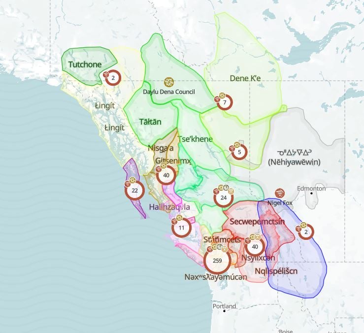
First Peoples’ Cultural Council have launched an online, interactive map to showcase Indigenous culture, language and art.
The First Peoples’ Map of B.C. has 18 layers that explore over 200 First Nations communities in the province. It features profiles of local artists, organizations and information about community events and heritage sites. Indigenous languages are also listed alongside common greetings and pronunciation guides.
“There’s no map like it in Canada,” said Hannah Mashon, communications officer at First Peoples’ Cultural Council. “[A map] that is weaving together the languages, arts and culture in one space. Something that can be a really good resource and learning tool for non-Indigenous people, but also for Indigenous people.”
The map is a fusion of two previous projects, the First Peoples Language Map and First Peoples Art Map. But it is also an ongoing, user-generated tool. Indigenous artists can go onto the map, create a profile and upload their portfolio. Experts, elders and knowledge keepers can also update and edit information.
“We had the community’s interests at heart when building this map,” said Mashon. “We wanted a place for them to contribute and to share their work. So that was definitely our main point, was to create a place for Indigenous communities to feel like their data is protected and is in a culturally safe place.”
But the map is also an educational tool for non-Indigenous people.
Northern Health started using the map for contact tracing and building connections with communities. BC Wildfire Service is also using the map to learn about heritage sites, that will in turn help them make culturally informed decisions.
“Right now I feel that there is a growing interest to learn about Indigenous cultures,” said Mashon. “And this is a really easy way for people to start exploring.”
Are you passionate about Canadian geography?
You can support Canadian Geographic in 3 ways:
Environment
How the Sahtuto’ine Dene of Déline created the Tsá Tué Biosphere Reserve, the world’s first such UNESCO site managed by an Indigenous community
People & Culture
The story of how a critically endangered Indigenous language can be saved
History
A look back at the early years of the 350-year-old institution that once claimed a vast portion of the globe
People & Culture
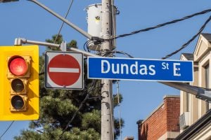
The history behind the Dundas name change and how Canadians are reckoning with place name changes across the country — from streets to provinces