This article is over 5 years old and may contain outdated information.

Science & Tech

Now you can virtually explore “Mars on Earth” in Google Street View

A new Google project zeroes in on Canada’s Devon Island, the most Mars-like environment on Earth
  • Mar 25, 2019
  • 647 words
  • 3 minutes
A person in a space suit and helmet stands in front of a rocky, dry landscape on Devon Island Expand Image
Advertisement

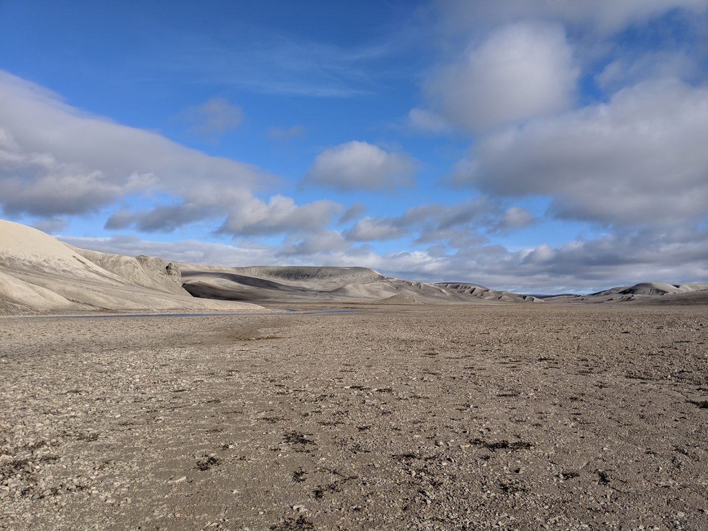
Devon Island in the Canadian High Arctic, the planet’s largest uninhabited island and the closest thing to Mars on Earth, can now be explored virtually via Google Street View.

The new Google project, which launched today, also features other visual assets to help aspiring explorers get a feel for the unique landscape of Devon Island and the research being done there, including a 10-minute documentary about NASA’s work on the island and a Google Earth guided tour.

The project was led by Katja Minitsenka, a program manager with Google, in collaboration with NASA, the Mars Institute and the SETI Institute.

“Google allows us a very unique opportunity to work on projects we’re passionate about,” explains Minitsenka, who has always had an interest in space exploration. Last March, she teamed up with Dr. Pascal Lee, chairman of the Mars Institute and director of the the Haughton-Mars Project (HMP), a field research project on Devon Island that’s funded by NASA.

After three months of preparation, Minitsenka, along with a small team of Googlers and NASA scientists, set out on a week-long expedition to HMP’s base camp on Devon Island.

The mission wasn’t easy. Due to the harsh climate, the expedition could only be conducted within a small window of time in mid-summer — “The only time when the island is not completely covered by snow,” says Minitsenka.

Breccia Hills polar desert landscape Devon Island Expand Image
The dry, rocky Breccia Hills on Devon Island. The unique geology of the island offers insights into how Mars was formed.
(Photo: Google)

Devon Island has no permanent infrastructure, so the team had to pack all their supplies in and waste out. During the long Arctic days, they travelled on all-terrain vehicles (ATVs) over rocky terrain, sometimes getting bogged down in thick mud. They also had to be on the lookout for polar bears.

The team used GoPro cameras to collect Street View footage and Pixel 3 smartphones to capture video footage for the documentary. “We couldn’t film every day,” says Minitsenka. “Every second day, we were snowed in!”

But the team was able to get what they needed and visit all the points of interest that NASA’s researchers are investigating.

Watch: A visit to Devon Island

Dubbed by scientists as Mars on Earth, Devon Island is a polar desert, even colder and drier than tundra. It’s a biome that’s practically unique on Earth, save for a few areas in Greenland and Antarctica. The island also has a large meteorite impact crater and other geological features such as canyons, valleys and gullies, all of which make it an ideal staging area for research and training for a future mission to Mars.

“It’s not as cold as Mars, it’s not as dry as Mars, but climatically it is an important step in that direction,” says Lee. “On top of that, Devon Island is a very barren, desolate, rocky place.”

Although astronauts may not visit Mars for another two decades, the goal of the Devon Island project is to help plan for future exploration of Earth’s closest neighbour.

As for Minitsenka, she hopes that being able to virtually explore the most Mars-like environment on Earth will inspire young people to enter into fields such as science, geology and engineering — or any field that will give them a path to exploration.

“Many young students are impeded by the fact that they think they need to have an extensive lab or tools to explore and become a scientist,” she says. “Seeing how the camp on Devon Island is organized, you can see that to do basic science, you really don’t need expensive equipment; you just have to have the passion.”

Advertisement

Are you passionate about Canadian geography?

You can support Canadian Geographic in 3 ways:

Related Content

Heinrich Scherer's 1702 chart of the North Pole

People & Culture

Why the North Pole matters: An important history of challenges and global fascination

In this essay, noted geologist and geophysicist Fred Roots explores the significance of the symbolic point at the top of the world. He submitted it to Canadian Geographic just before his death in October 2016 at age 93.

  • 5167 words
  • 21 minutes

People & Culture

On thin ice: Who “owns” the Arctic?

As the climate heats up, so do talks over land ownership in the Arctic. What does Canadian Arctic Sovereignty look like as the ice melts?

  • 4353 words
  • 18 minutes
An aurora dances in the night sky

Science & Tech

Solar to the max

For scientists and northern lights rubberneckers, 2013 promises to be a once-in-a-decade opportunity to experience the sun’s magnetic power at its height.

  • 2456 words
  • 10 minutes
english Bay, Vancouver

Science & Tech

How Canada is preparing for the next big earthquake

The last megathrust earthquake to strike Canada was in 1700, and the clock is ticking. How we’re preparing for the impact.

  • 2809 words
  • 12 minutes